Welcome to your ultimate guide for adventure planning, covering hiking, cycling, skiing, and exploring the Alps by car or public transport. Whether you're an avid outdoor enthusiast or a casual explorer, our comprehensive tools and features are designed to enhance your travel experience.
Plan Your Route
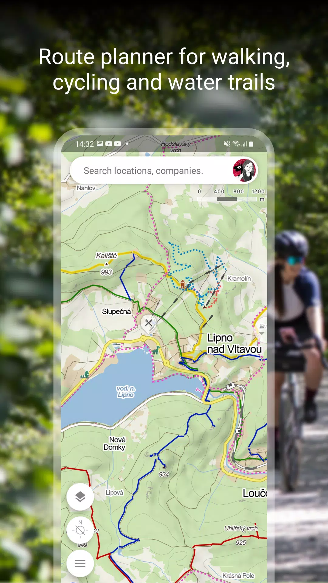
Start your journey with our detailed route planning tools:
- Hiking and Cycling Trails: Discover a variety of trails suited for all skill levels and interests.
- Cross-Country Skiing and Ski-Alpine Trails: Plan your winter adventures with precision and ease.
- Unique "Travel Tips" Feature: Let our app curate a trip through the most fascinating spots in your chosen area.
- Route Elevation Profile: Get a clear picture of the terrain you'll be navigating.
- 5-Day Weather Forecasts: Stay informed with accurate weather, temperature, wind, and precipitation forecasts for any location worldwide.
Browse the Tourist Map of the Whole World
Explore the world with our extensive mapping features:
- Hiking, Bike, and Single Trails: Navigate through a network of trails tailored for different activities.
- Road and Path Markings: Detailed markings for roads, mixed cycle paths, unpaved paths, and footpaths.
- Hillshade and Ferrata: Visualize terrain and assess the difficulty of via ferrata routes anywhere in the world.
- Educational and Accessible Trails: Discover educational trails and routes designed for wheelchair users, as well as pedestrian zones and national parks.
Switch to Other Map Layers
Enhance your exploration with diverse map layers:
- Aerial and Panoramic Views: Get an aerial perspective of the world and panoramic images of Czech streets, along with a 3D view.
- Winter Maps: Stay updated with current cross-country ski trails and ski resorts.
- Traffic Maps: Access real-time traffic information, road closures, and parking zones in the Czech Republic.
Download Offline Maps
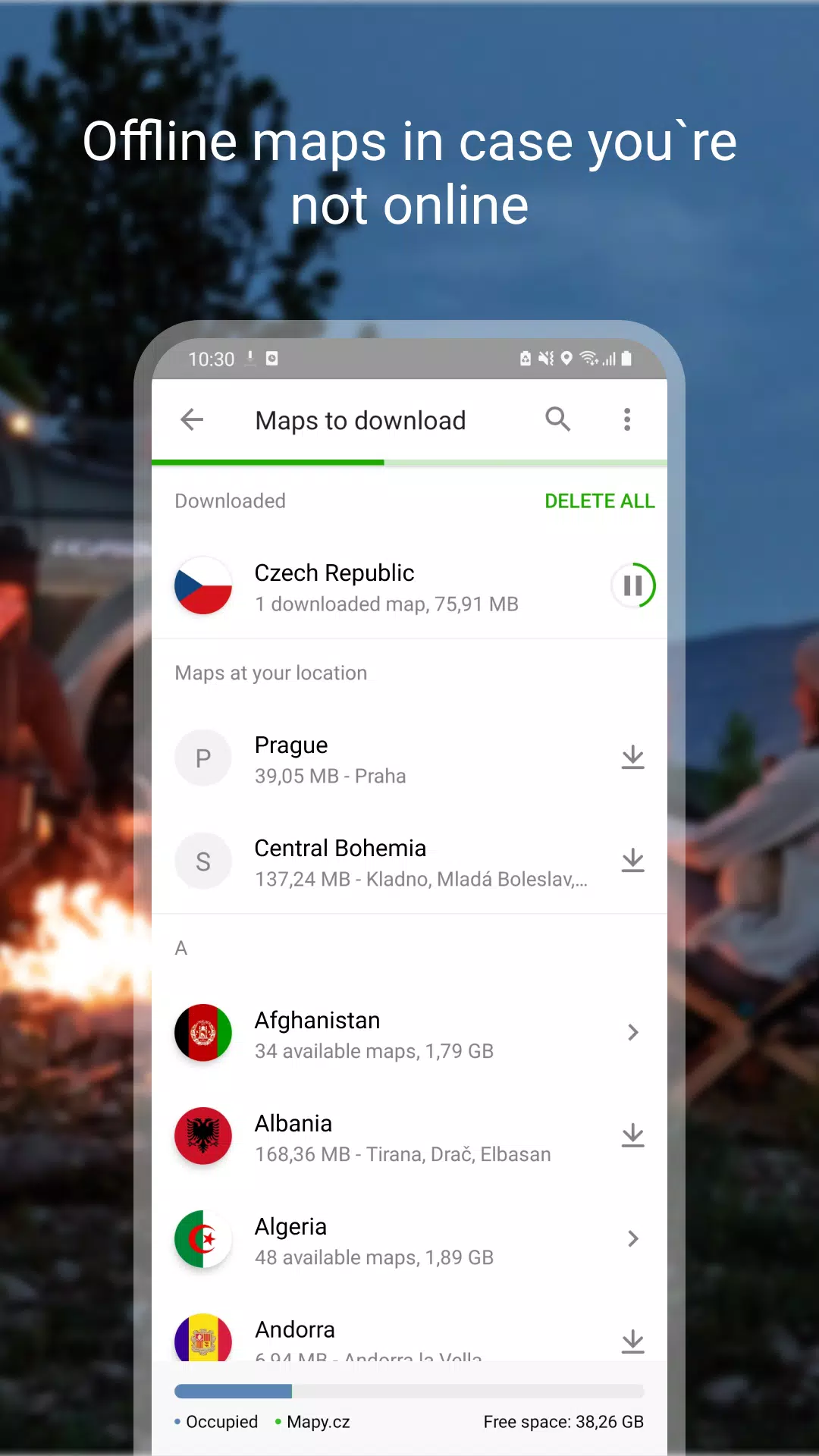
Prepare for your adventures with offline capabilities:
- Offline Tourist Maps: Download maps of the entire world, complete with hiking and cycling trails.
- Offline Voice Navigation: Navigate without an internet connection for drivers, cyclists, and pedestrians.
- Offline Winter Maps: Access detailed winter maps of the Czech Republic, including cross-country skiing trails and ski resorts.
- Region-Specific Downloads: Download individual regions for focused navigation and exploration.
- Offline Search and Planning: Search for places and plan routes worldwide, even without a signal.
Free Navigation for Drivers, Cyclists, and Pedestrians
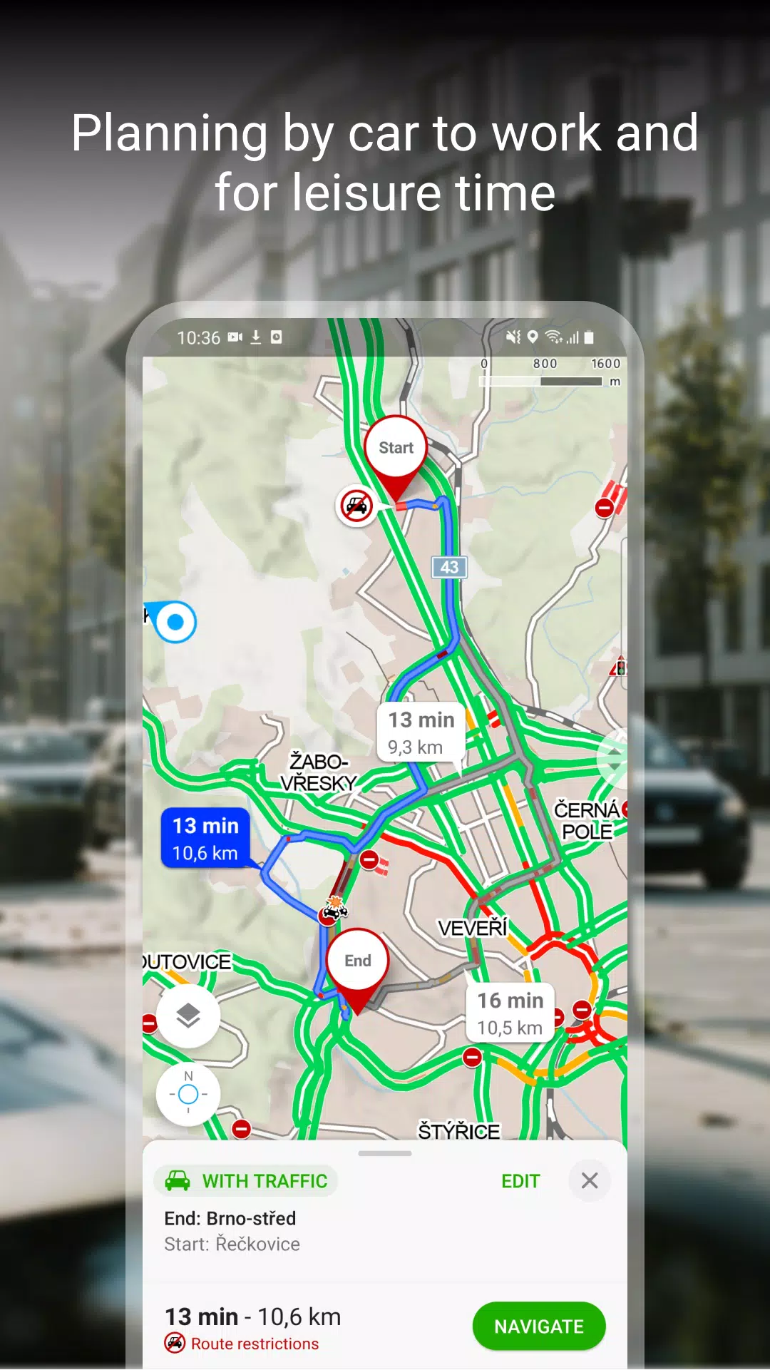
Navigate with confidence using our advanced navigation features:
- Clear Lane Guidance: Receive precise instructions on which lane to use.
- Roundabout Navigation: Easily navigate roundabouts with highlighted exits.
- Toll Avoidance: Opt to avoid toll lanes for a smoother journey.
- Dark Mode: Enjoy navigation in a comfortable dark mode setting.
- Share Your Journey: Share your estimated arrival time, route, and current location via SMS, email, or chat.
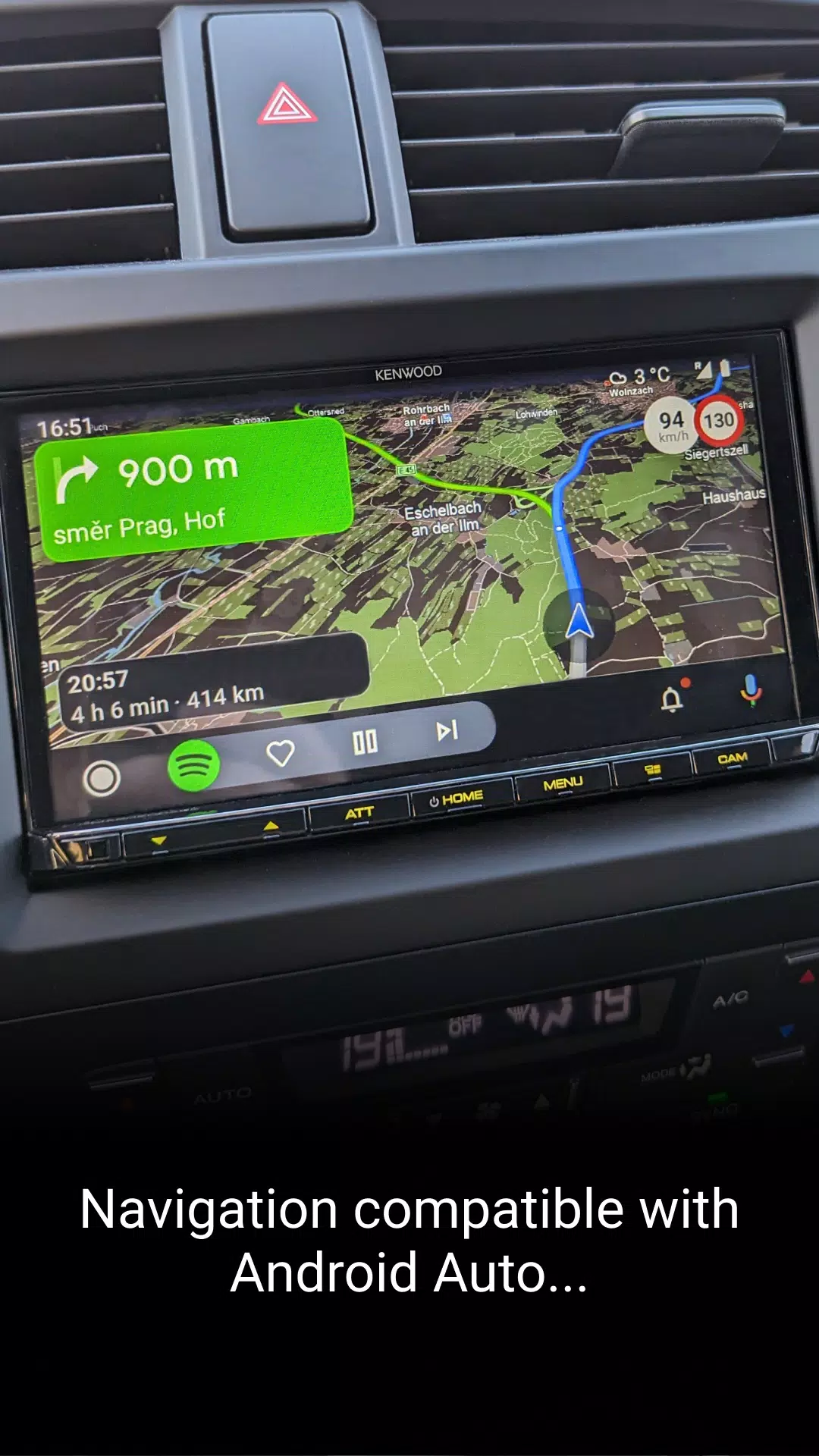
- On-Board Display Integration: View navigation on larger screens through Android Auto and Apple CarPlay.
- Speeding and Traffic Alerts: Stay safe with speeding alerts, speed camera notifications, and real-time traffic updates in the Czech Republic.
Save to My Maps
Organize and track your adventures:
- Save and Organize: Keep places, routes, photos, and activities neatly organized in folders.
- Activity Tracking: Use Tracker to monitor your progress in walking, cycling, running, cross-country skiing, and hiking.
- GPX Compatibility: Import, export, and upload GPX files for seamless route management.
- Cross-Device Synchronization: Sync your planned routes across multiple devices for a consistent experience.
Choose by Reviews of Places, Restaurants, and Services
Make informed decisions with user-generated content:
- Up-to-Date Photos: See what places look like through recent user photos.
- User Experiences: Read about others' experiences with food, service, ambiance, and pricing.
- Search by Rating: Filter your search to highlight top-rated establishments.
Recommendations and Tips:
- An internet connection is required to download maps.
- Ensure location services are enabled on your device for optimal app performance.
- Background location access is necessary for the location sharing feature.
- Use the in-app form for any questions or troubleshooting needs.
- Be aware that using the app in the background with GPS active may drain your battery.
- Join our vibrant user community at www.facebook.com/Mapy.cz/ to share your experiences, stay updated, and suggest new features.

 Download


 Category


Streamline your social media strategy with our curated collection of powerful management tools. This guide features popular apps like TikTok Studio for content creation and analytics, Instagram for visual storytelling, Facebook Gaming for live streaming, Twitter Lite for efficient tweeting, and more. Discover how Likee, WorldTalk, Quora, Moj, Amino, and Live.me can enhance your social media presence and help you connect with your audience. Learn tips and tricks to manage multiple platforms effectively and maximize your reach. Find the perfect tools to boost your social media success today!
Live.me
WorldTalk-Date with foreigners
Facebook Gaming
Instagram
Likee - Short Video Community
Quora
Twitter Lite